Showing posts with label North Carolina. Show all posts

Wednesday, June 25, 2014

Looking Towards the AT: Tennessee and North Carolina Between the D's

Section: Tennessee and North Carolina Between the Ds*.
Region: South
Miles of trail: 225.6
Highlights: Hot Springs, NC, Max Patch, Roan Mountain and it's related balds, Overmountain Shelter, Lake Watauga, Laurel Falls


AT marker in Hot Springs, NC. The trail along the town's sidewalks are marked with this symbol.
So you're at Davenport Gap on the northeast end of Great Smoky Mountains National Park. Now what? Is it time to give up, considering you've just been through one of the most scenic places in the Eastern United States? Of course not!

Wednesday, June 4, 2014

Looking Towards the AT: Great Smoky Mountains National Park


Section: Great Smoky Mountains National Park
Region: South
Miles of trail: 70.1 
Highlights: Clingman's Dome, Spence Field, Charlie's Bunion, Mount Cammerer, Siler's Bald, bears, long periods in the rare spruce-fir zone of the southern Appalachians, salamanders


A bit more than 150 miles into the trail* hikers on the AT say goodbye to the Fontana Hilton, walk across the dam**, and go past a small sign welcoming you to the national park, with a white blaze on one of the posts telling you that you are heading the right direction. 

Friday, May 23, 2014

Looking towards the AT: North Carolina to Fontana

Note: Over the next year, we'll be sharing our thoughts on the sections of the Appalachian Trail that we will be walking next year. Only a few do we have any even remotely significant experience with, but we still have thoughts on them that we'd like to share. After we finish our hike, we'll be able to look back at these and see if we were pretty astute with our thoughts, or way off the trail. Although many of the sections are broken down by state, some (such as VA, NC, and TN) will be broken into smaller portions due to length of trail and special circumstances. Next up is North Carolina to Fontana Dam. 

Section: North Carolina (to Fontana Dam at the entrance of the Smokies)

Region: South
Miles of trail: 86.2 
Highlights: Standing Indian Mt, Winding Stair Gap, Wayah Bald, Wesser Bald, Nantahala River and Outdoor Center, Fontana Dam


I have a confession to make.

I know very little about the Appalachian Trail.

Oh, of course I know what it is and the general where, of course. I know the states it goes through, and the types of topography and ecosystems I'll be hiking through. Unlike Andrew, though, I just don't have the mind for memorizing information about the trail that I haven't experienced first hand. This means I have a whole lotta learnin' in the year ahead of me.

Thursday, April 10, 2014

Journal of the Smokies - The Road to Nowhere

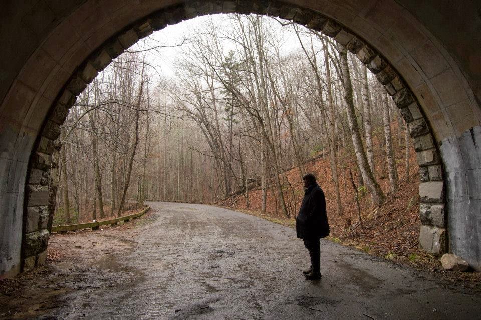
Me at the far end of the tunnel on Lakeview Drvie in GSMNP. Photo by Erin
Some of America's national parks were not controversial to establish. Most of them, especially the western giants, were on land already owned by the federal government. Sure, there were some contentious battles over grandfathered leases and a whole mess that led to a uranium mine operating at the Grand Canyon for years after the park had been established around it. But in large part parks like Yellowstone, Yosemite, Glacier and Rocky Mountain did not involve a lot of displacement of inhabitants.

Monday, March 31, 2014

Journal of the Smokies: A Lack of Hiking Experience

Note: Journal of the Smokies is a new feature on this blog. The Great Smoky Mountains is one of the jewels of the National Park System, and the park visited by the most people each year. It's also the most visited park by Andrew, and one of Erin's most frequently visited. From visits long past and recent we'll be sharing some of our thoughts and pictures. This will be a cross platform feature, as we'll be sharing pictures and short posts in the series on our Walk With Nature tumblr as well.


Since I began hiking in earnest again in October of 2010, I've hiked hundreds of miles in states from Virginia to California, and Florida to Michigan. I've hiked to the top of the highest points in Georgia and Tennessee, hiked all 600 steps at Amicalola Falls, and went to the top of Blood Mountain along the Applachian Trail. I've a hiked a lot of miles, but very few of those have been in Great Smoky Mountains National Park.

Friday, November 8, 2013

Why Hello Again, Appalachian Trail!

Note: This started as a mere image post on our Tumblr, but became something more. As it became a full-fledged post, I figured I'd cross post it to here, as we've not had a post all week, and I kind of like it. My Hiking Training Plan recaps will return next week, unless a hectic work week pushes it off until the next week.


The picture is from my latest visit to the Appalachian Trail, at Newfound Gap looking Southbound across US 441. Sure, it's not exactly the hardest spot to reach, or the most strenuous of hikes, but it's still part of the trail. And also the first portion of which I ever visited, even though I'm pretty certain I wasn't aware of it at the time. I visited Great Smoky Mountains National Park with my family several times when I was growing up, many of which coming at a time when the Appalachian Trail was little more to me than a long winding red line going across several eastern states in the atlases I loved to read. On at least a few occasions we stopped at Newfound Gap, and at some point walked across the path of the Appalachian Trail as it crosses the large parking lot.
Since I've become an adult I've driven over Newfound Gap many times, and rarely have I done it without making a stop to view the sweeping vistas of the ancient mountains of Tennessee an North Carolina. Most of the time i make a point to walk to either the crosswalk heading south towards Springer, or the point where the pavement ends and the trails heads northbound on the much longer journey to Katahdin. Common sense has kept me from venturing forth in either direction without provisions, shelter, and proper hiking attire. Someday I fear it may fail, and I may find myself on an unexpected journey into the back of beyond.

Tuesday, December 11, 2012

Springer Mountain and the BMT, part 2.

The first weekend of December, my sister and I went to Northern Georgia to do some hiking. While I was living in Chattanooga I had purchased a book with 50 trails in the North Georgia mountains, and I wanted to knock a couple of these trails out. We used some free nights I had earned from a hotel loyalty program I was part of, and set our minds to hike one trail on Sunday and one on Monday.

We got into Helen, GA fairly late on Saturday, and ended up getting up much later than I had hoped on Sunday. It wasn't until after noon that we got started out for the day. After a trip to local IGA for some supplies, we decided to walk the Tennessee Rock trail up at Black Mountain State Park (the highest state park in Georgia). Of course it was unseasonably warm, so we thought it would be a great day for a hike up in the mountains.

After a nice drive through mountains and lunch in Clayton, GA, we made the turn off of US 441 towards the state park. Lo and behold the highest state park in Georgia is also a park that closes in the winter. So it is 70 degrees out (OK, probably around 55-60 up in the mountains), the sky is crystal clear, and the freaking State Park is closed. They were so rigid they didn't even have one last weekend before closing. Apparently December 1 MEANS December 1 to Georgia State Parks.

Because of our late start, the early sunset, and the fact that Tennessee Rock was the farthest away of the three options, we had effectively ruined our shot at hiking much of anything on Sunday. Instead we drove even farther, through Franklin and up to Wayah Bald. Wayah Bald is a high point on the AT in North Carolina, and is one of the easiest points on the trail to get to that isn't on a road crossing (or train station). All it takes is driving up a winding road from Franklin, then drive up another winding gravel road, and park at the nice new paved lot. From there it is a short walk along the paved AT to the Wayah Bald tower, which provides a panoramic view of the Blue Ridge of TN, NC, and GA. From atop the tower, we could see Clingman's Dome, the highest point in TN and the AT. It's hard to believe that it is less than thirty miles in a straightline to there. By car it would take about two hours or more to get there, and by foot it would take many days of grueling ups and downs to reach it.

The short walk to and from Wayah Bald was the sum total of our hiking that day. However, we enjoyed a nice drive through the now leafless mountains, and some excellent views atop that peaceful bald. I don't consider it a waste, and considering how much of an ordeal the next day turned out to be, I'm kind of glad I didn't walk several miles on Sunday. But that's another story, one that my sister tells so well.

Thursday, August 2, 2012

Walking Along the AT: Fontana Dam

Date: March 27, 2012
Direction: NOBO, then SOBO
Distance: ~1 mile round trip
Start (NOBO): Fontana Dam Visitors Center
End (NOBO): Entrance to Great Smoky Mountains National Park


Fontana Dam on the Little Tennessee River is the highest dam east of the Rocky Mountains. Sitting on the border of Great Smoky Mountains National Park, it is a stunning sight, sitting high above the river valley below it. The lake behind it, Fontana Dam, is a popular lake for fishing and boating. For me, however, it is most important as the entrance of the Appalachian Trail into the Smokies.

Like Hot Springs, the walk at Fontana was both mostly flat and fairly short. For most of the way I walked on the raised sidewalk next to the roadway on top of the dam. On the way across I walked on the lake side and enjoyed the view of the Smokies rising up behind the lake. Before long I had crossed the dam and walked into the grass towards the sign marking the entrance to the National Park. Had I continued, I would have walked along a road for a while, before returning to the trail and a hell of a climb up the ridge line of the Smokies. As tempting as that was, I found it much more prudent to turn around. Making a several thousand foot climb on a whim with few supplies was not a recipe for success.* Instead I walked back across, this time on the side of the dam wall. From here I got a view of the high peaks on the south side of the dam, which were close to where the AT had come from.

A short walk from the Visitors Center at Fontana Dam is a shelter known as the "Fontana Hilton". It is called this because of its proximity to actual bathrooms, showers, and a resort complete with buffet. On a previous visit I walked along the effective path of the AT from a parking lot towards the shelter. I saw it in the distance, but did not approach because I wanted to let the hiker there do what they were doing in peace. The close bathrooms were locked at that time, but it was still winter time, and thus not peak hiker season.

I've actually had the fortune of seeing the AT at its western entrance to GSMNP at Fontana, and its eastern exit at Davenport Gap. As I've seen its crossing of US 441 at Newfound Gap many times, I suppose you can say I've seen both ends and the middle of this memorable section of the AT. However, I still have almost the entire 70 mile stretch yet to actually experience IN the park. This is something I hope to rectify, preferably sooner than later.

Next Week: I walk up to Round Bald, and marvel at the majesty that are the Roan Highlands.

Fontana Dam


*Besides, I had to make it to Wayah Bald before sundown. By going there, I was able to experience sunset atop one of the great panoramic views along the Appalachian Trail, as well as meet a few honest to god thru-hikers. And all it took was a few miles of bumpy driving, and an embarrassingly short walked up a paved trail (most of which was the AT).

Friday, July 27, 2012

Walking the AT: Hot Springs, NC

Date: October 30, 2011
Direction: SOBO, then NOBO
Distance: 0.7 miles out and back
Start (SOBO): Downtown Hot Springs by the French Broad bridge
End (SOBO): AT Crossing of NC 206


Not every walk I have taken on the AT has been as arduous or as long as the walk up Blood Mountain. In fact, once I had actually figured the distance I walked in Hot Springs, it was shorter than I remembered it. Honestly it wasn't long enough to keep in here, considering I threw out a walk along the AT at Newfound Gap that was almost as long. However, I decided to allow it because a) I can and b) it was my one and only walk through a trail town.

Other than maybe Fontana, the walk through Hot Springs was the flattest of my walks. There was a slight rise from the river to the crosswalk on the edge of town, but nothing too arduous. Of course, not too far past where I started and turned around you would be ascending rather quickly.

The most interesting part of the walk was the fact that the AT symbol was put into the sidewalk at regular intervals. I didn't stop at any of the store or restaurants, as I was in a hurry (I had to return to IL that night). However, it looked like it would be a nice town to visit. Despite walking through a town, I actually did see some wildlife, as a very fat groundhog ran for cover under the porch of one of the houses.

Although the Appalachian Trail spends most of its time in the wilds of the Appalachian Ridge line, it does travel through or near several towns. There are a few "trail towns" to the south, such as Franklin, NC and Hiawassee, GA, but these require either a shuttle or a hitch to reach. Hot Springs is the first town that you reach going NOBO that is actually on the trail. If you were to continue, you'd run into several other towns, such as Damascus, VA, Duncannon, PA, and Hanover, NH. Probably the most well known (to those who aren't Ivy Leaguers, at least) is Harper's Ferry, WV, which is home to the Appalachian Trail Conservancy. I'll have more to say about this trail town in #7 of this series.

A town day is one of those tangible goals that send many a thru-hiker barreling down the trail. The thought of good, hot food, clean laundry, and perhaps even a warm bed is a major incentive to them. Walking back I could imagine how it must feel to them to finally have ended that decline into town, and see the beckoning signs of restaurants, stores, and a post office. Perhaps they'd just spend a few hours in town, recharging before making that climb back up, or maybe they'd take the rest of the day off, and tomorrow as well, giving themselves an actually zero day. For some, that zero day might even become a zero week, or even the end of their trip. Perhaps some day I'll be making that decision for a nero, a zero, or just a short stop. My first visit instead ended with me getting in my car and heading off on a long drive back to IL.

Next week: Another flat trip, this time over the highest dam east of the Rockies.

*I've driven through Damascus twice, as well as Erwin, TN once. Erwin technically isn't on the trail, but the extreme southern edge of town does brush up against the trail as it crosses a river.