 |
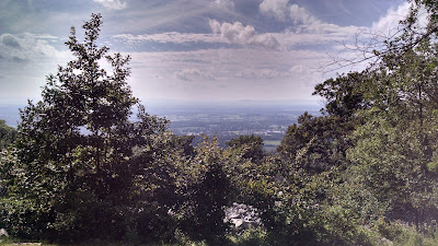
Looking down into the valley where Boonsboro, Maryland is, from the George Washington Monument State Park.
|
It's "common knowledge" for AT hikers that Virginia is flat and Maryland is easy. Having hiked 30 miles or so of the Appalachian Trail in Shenandoah National Park in Northern Virginia, that first bit of conventional wisdom can be put to rest. But what about the second one? It can't be that difficult, if some people cross the state's 40.6 miles in one day, right?
Having crossed the entire state using nothing but my feet, I can confirm that Maryland is
mostly easier, at least compared to Georgia and much of Shenandoah. After all, the first three miles or or so is effectively flat, following the recreated C&O Canal towpath from Harpers Ferry to the point where the AT heads towards the ridge line of South Mountain. After the one truly large climb up past Weverton Cliffs, the rest of the hike in Maryland is effectively spent along the ridge of South Mountain. There are still the usual descents into gaps and climbs back up, but these climbs are often measured in tens, instead of hundreds (or thousands) of feet in elevation change.
 |
| Maryland Heights, across the Potomac River from Harper's Ferry. This picture is taken from the C&O Canal Towpath, which is maintained by the NPS from Washington, DC to Cumberland, MD. |
Many miles of the trail are wide with even footing, almost as if walking on a dirt/rock road. You pass through two state parks and a county park complete with power outlets, restrooms, and clean running water, one of which is close enough to get pizza delivered. Beyond that, there are many road crossings, often no more than a couple miles apart. A wilderness experience the hike through Maryland is not.
 |
| War Correspondents Memorial, at Gathland State Park. This memorial was built by George Alfred Townsend, a former war correspondent during the Civil War and a once popular author. The state park is situated on land he once owned. |
However, that doesn't mean Maryland is a complete cake walk. Sure, it shouldn't be a problem for hikers who've conquered the 1000+ miles of the trail to the South. But in a few places, it can slow even through hikers down, and can be an absolute nightmare to novice hikers, or those with feet that are ultra sensitive to rocks. Some segments of the trail seem to be nothing more than dry creek beds, with you just walking down rocks of variable steadiness. Although very short, the climb up and down a ridge just before Raven Rock in the north is the closest Maryland comes to the rugged up and down trail of Georgia. One short, but nerve-wracking, section of the trail is a full-on rock walk, where it's a good idea to take you trekking pole straps off from around your wrists, and you have to keep extra care with your balance, as the rocks can easily shift on you.
Unlike many states along the trail, Maryland is very stringent in allowing camping only in authorized sites. This includes six shelters (Ed Garvey, Crampton Gap, Rocky Run, Pine Knob, Ensign Cowall, Raven Rock), a primitive campground (Pogo Memorial), a primitive but maintained campground (Annapolis Rocks), and Dahlgren Backpacker Campground, a veritable backpacker resort with its running water, toilets, power outlets, and showers. These campgrounds and shelters are spaced out in a way that even slow hikers (like yours truly) can make it from one to another without having to go beyond their hiking comfort zone. Each of the shelters and campgrounds, save for Pogo Memorial and Ed Garvey, have either bear poles or bear cables, so you don't have to worry about throwing up your bear bag. This is good, because many of these areas don't have great trees for bear bagging.
The shelters range in quality from old and small but cozy to very new. Two (Rocky Run and Raven Rock) have beautiful hardwood floors that are a treat to sleep on, at least compared to some of the other shelter floors I've seen. I did not encounter any issues with the usual denizens of the shelters (mice), let alone other potential interlopers, be they raccoons or bears. Beyond that, I'll leave individual descriptions of the shelters for another volume of my shelter rankings.
 |
| Ed Garvey Shelter. A nice shelter, with the second level accessed by its own ladder and door in the back. The one drawback were nuts from a tall tree falling on the metal roof. |
The trail in Maryland starts easy, and it ends easy. I must admit here that I skipped a portion of the trail heading into Pen-Mar park. This was in part because I had to be into Pen-Mar by a certain time to meet my shuttle, and partly because my legs weren't ready for a boulder hop down from the ridge into the park.Instead, I hiked down the road from a hang glider launch/overlook, rejoining the trail in the park. From there it was a gentle walk down an old road (possibly an old railroad grade) across active railroad tracks, and down a short trail to where a sign marks the border between Maryland and Pennsylvania. It took me nine days of hiking, or about three times what a typical through hiker would need, but I made it, covering the entire journey with my own two feet.
 |
| Me at the end of my hike across Maryland. The mail box is used to hold the log book for this border, which is also the historic Mason-Dixon line dividing the North from the South. |
All-in-all, if you are looking for a good idea of what hiking the Appalachian Trail is like, but don't want to get in too deep, try hiking a few miles in Maryland. Rocky Run and Pine Knob shelters are easily accessible if you want an overnight experience along the trail. As for views, High Rock can be reached by road from Pen-Mar park (which also has its own scenic overlook), and Annapolis Rocks is a pretty easy 4 mile or so round trip from a parking area along US 40.


No comments :
Post a Comment